• Hidden Stories in Nautical Charts

  • Singapore Uncharted: Hidden Stories in Nautical Charts

    Beyond the familiar tales of modern Singapore, a deeper narrative lies hidden within our nautical charts. Join us as we navigate through eleven historically significant sets of charts – from 1819 to today – to uncover the untold stories of our island’s past.

    This talk goes beyond dates and data, using these charts as a lens to understand how ancient sea lanes shaped our economy, how early surveys reveal surprising details about our geography, and how our maritime history continues to influence our identity and strategic importance today, especially as we celebrate SG60.

    Discover how the unknown past of Singapore’s seas is still profoundly relevant in our present.

    Unveil the secret survey of Singapore harbour before the signing of the treaty with the Temenggong in February 1819.

    Reveal the on-going challenge in countering piracy in Singapore’s waters since the 19th century.

    Surface the naval charts of Singapore which were produced by Germany and Japan during WWII.

  •  — David Lim “The Singapore Maritime Heritage Interest Gro’s efforts in promoting our maritime stories have enriched our cultural landscape. Their work is vital to preserving our national identity.”  Our community has celebrated over 300 stories that preserve Singapore's maritime legacy To share, promote, encourage, and support both the tangible and intangible aspects of Singapore's maritime-related heritage.

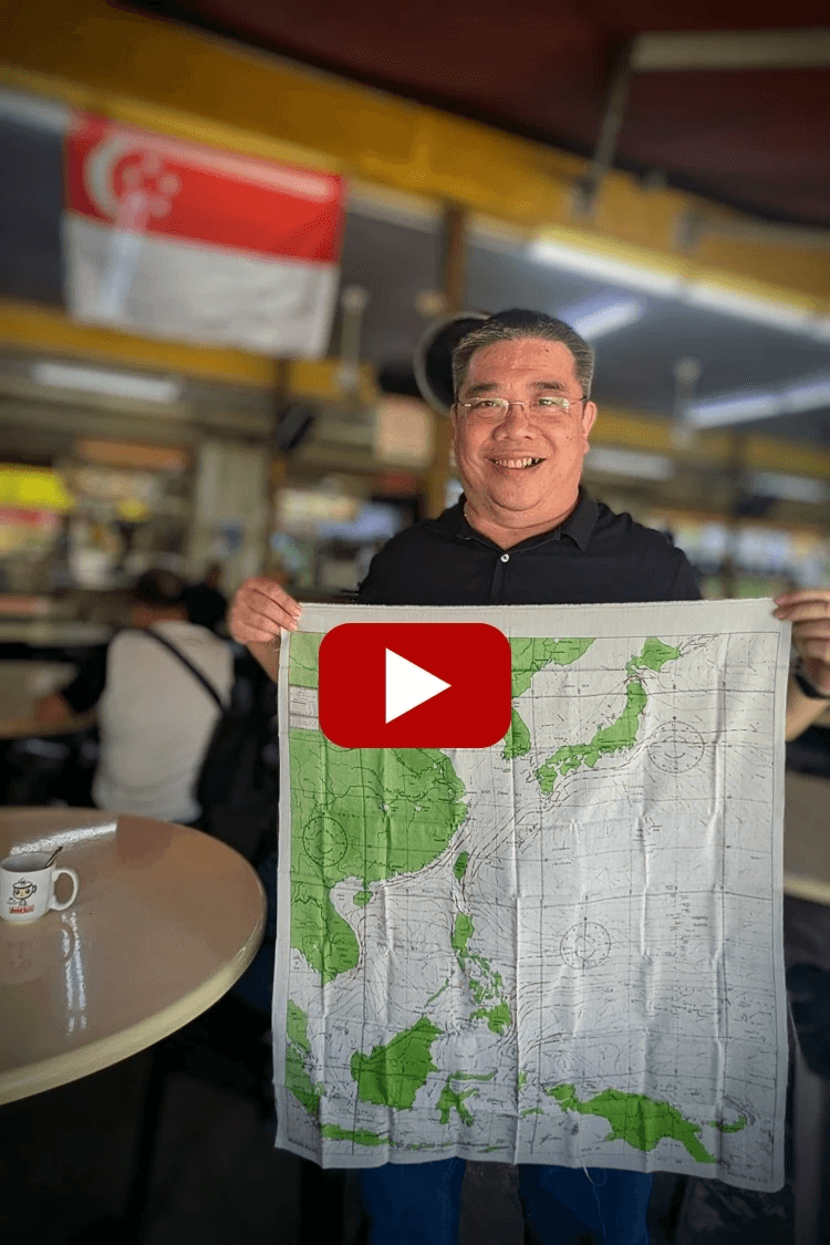
    Speaker - Mr. Mok Ly Yng

    Mok is a map research consultant in Singapore specialising in the historical maps of Singapore. He was the Head of the Geographic Branch in the National Mapping Agency of Singapore: SAF Mapping Unit. He had also worked at the National Archives of Singapore as a map researcher.

    He has been in the mapping industry for close to 30 years now. As a freelance consultant, he was involved in various map-related exhibitions with the National Library of Singapore, the Urban Redevelopment Authority and the Maritime and Port Authority of Singapore.

    Mok has also given public talks on maps and their related tales over the years at the National Library of Singapore, National Archives of Singapore, National Museum of Singapore, NUS and URA.

    He obtained his MSc in Geographical Information Systems (GIS) from the University of Edinburgh. He is a Fellow of the Royal Geographical Society in London.

  • ​Date:
    6 September 2025​ (Saturday)

    Program:
    1000hrs – Registration
    1030hrs – Admin & Safety Brief
    – Opening Remarks
    By COL Rinson Chua, Navy representative from the Navy Museum Panel
    – Presentation
    1115hrs – Q&A
    – E-Feedback
    – Group Photo Taking
    1145hrs – Halal Light Refreshments
    ​ – Networking
    – Free & Easy Navy Museum tour
    1300hrs – Free Gangway

    Venue:
    RSN INVENT CAMPUS (Next to Singapore Navy Museum)
    112 Tanah Merah Coast Rd, Singapore 498794

    ​
    Getting There:
    By Public Bus:
    Take the MRT or Bus to Bedok Interchange. From there, hop on Bus 35

    By Car or Private Hire Vehicle
    Drive directly to the Navy Museum. There are 100 complimentary parking slots available, and no security pass is needed.

    Going Back:
    By Public Bus
    Take Bus 35 back to Bedok Interchange (Last bus: 3:00 pm)

    By Museum Shuttle Bus
    A 20-seater shuttle bus is available to take you to EXPO MRT Station at these times: 11:30 am, 12:30 pm, 1:30 pm, 2:30 pm, and 3:30 pm.

    Registration:
    ​Please click here to register online. ​

  • ​A key takeaway....

    Section image
  • The story of the two 1819 charts offers a powerful lesson on how narratives are shaped, and it remains highly relevant today.
    https://youtu.be/qi0Kk-g_rjY?t=545

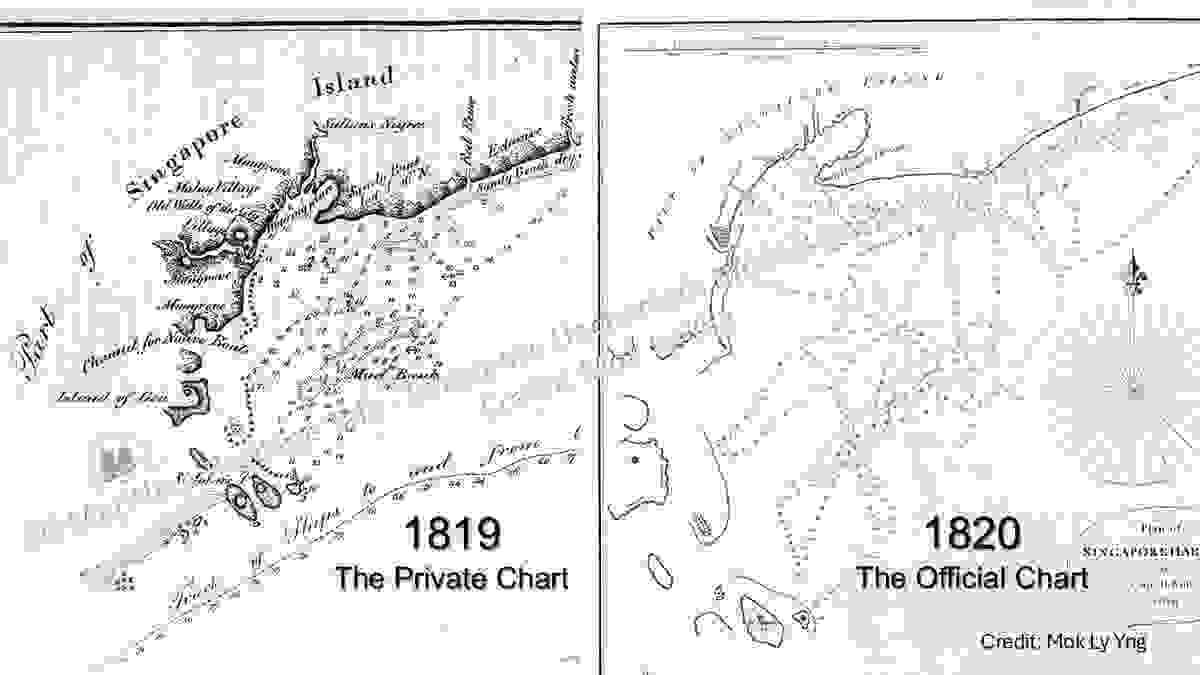
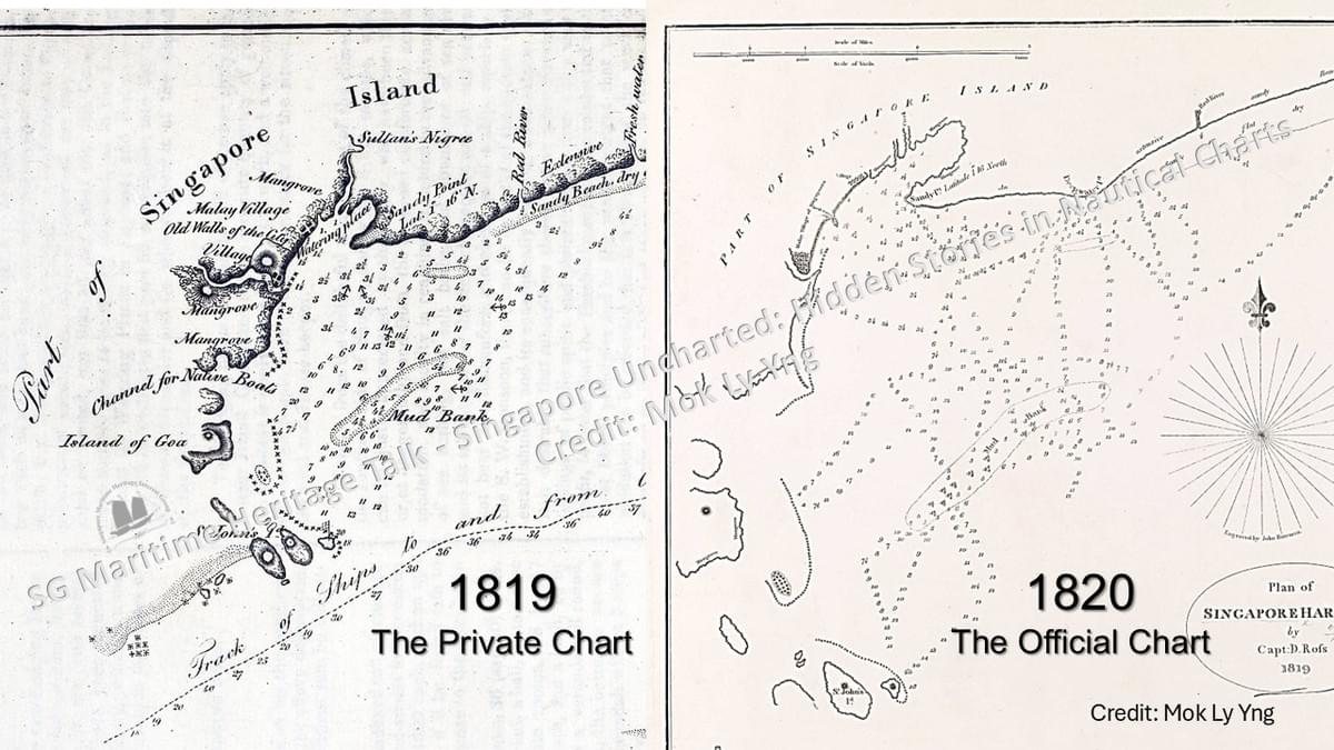
    This story isn't just about old documents; it's about how history can be shaped by what's included—or left out. The talk reveals a key difference between two charts from 1819.

    The Private Chart: Published in a newspaper, this chart was packed with detail. It accurately showed a "channel for native boats" and even marked the locations of Malay villages. This wasn't an empty island; it was a vibrant, lived-in place.

    The Official Chart: The British East India Company's official chart was suspiciously sparse. It omitted the local villages and, most importantly, the native channel.

    This deliberate omission allowed the British to tell a powerful, though misleading, story: that they "discovered" Singapore and created its port from nothing.

    This serves as a powerful reminder that narratives are often shaped by those in power. A key takeaway is the need to be critical of information, particularly that which may be motivated by a hidden agenda, as the details that are omitted can be just as telling as the ones that are shared.

  • Photos